
The forecast was rain. 80% chance of rain with a nasty little lightning threat on it. You can imagine I was NOT impressed. One day I will find a wonderful solution for the rain on glasses issue but so far it has alluded me. Contacts seemed the obvious choice but, alas, my eyes are just messed up enough that there is no match to my eyes. I have some close to matching contacts but I HATE them as nothing is quite right.
Solution? We got out of the house as quick as we could to a nearby country park with enough trees to give a bit of protection for when the downpours arrived. Rushmere Country Park near Leighton Buzzard was the nearest choice. It is a great choice as well though and you might remember that it is the parent park to Stockgrove where we walked a few weeks ago. This time we only touched on Stockgrove and most of this walk was not part of the previous one. We did manage to walk most all of the Parkrun route but not in the order it happens at Parkrun which made it very interesting at times.

Being the fly by the seat of our pants types, we picked up this handy dandy map at the visitor centre on the way out.Might I recommend getting your own little map but on the way in rather than out. Would that have changed out route…probably and that would have been sad. We only went off map once between Baker’s Wood and the Britis Legion Building in Heath and Reach. On the map you can just about make out an unmarked entrance between pictures 3 and 8 on the right hand side of the map.
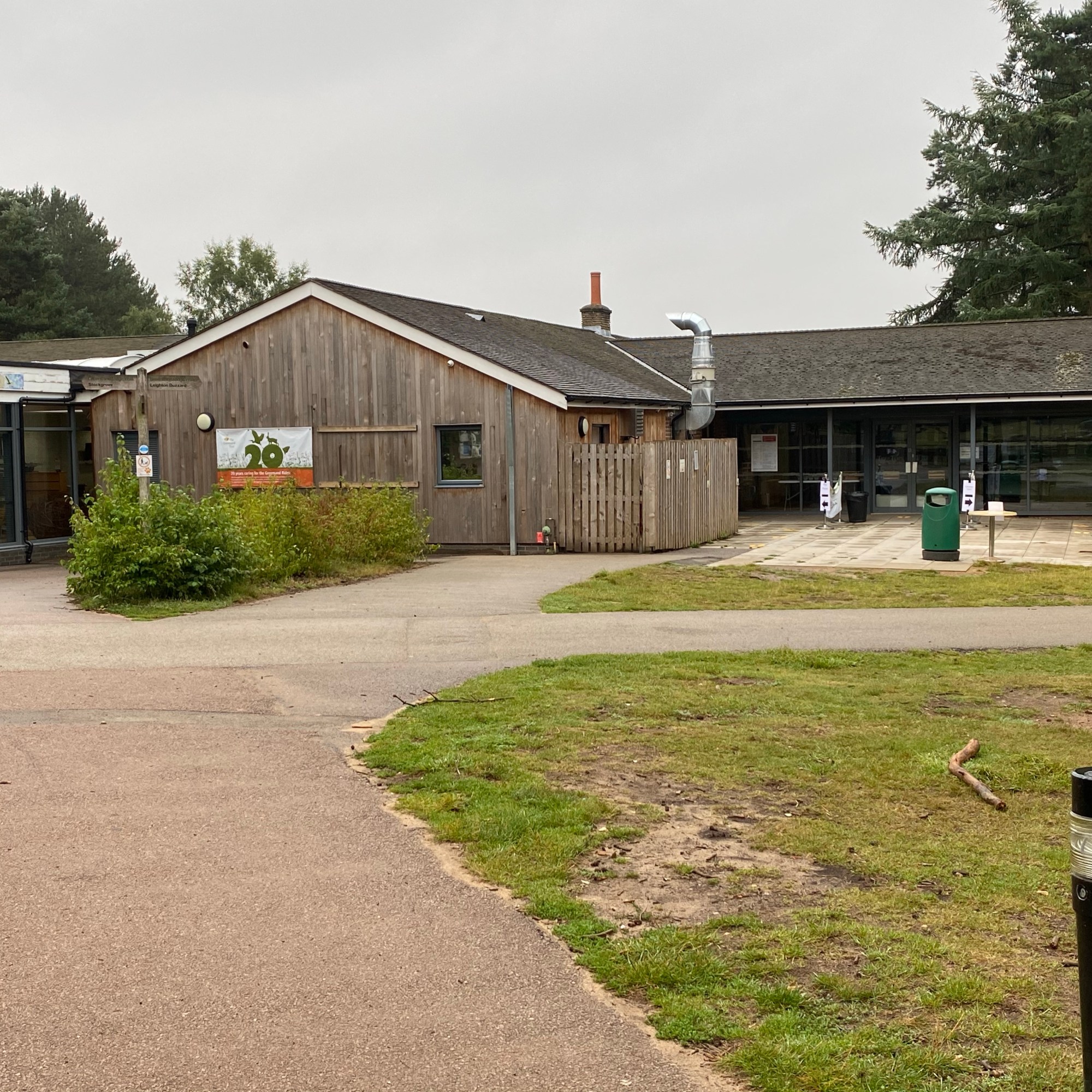


We started at the visitor centre. You will not that they have toilet facilities and a little outside cafe where you can get teas and coffees at least. Normally the centre has a lovely big cafe but we are still doing the socially distancing thing. When standing facing the visitor centre turn left to go dow the path next to the small outdoor cafe. On the map this is marked with a big green 1. Follow this path all the way down to the end of the path. You will see a fence and a gate. Go through the gate and turn to the right but up the hill.
You are going to follow the path along with a fence on your right for much of the way. eventually you will come to a clearing with a sundial in the middle. At this point you are on the Woodpecker trail and it will lead you down to Stockgrove Park visitor centre. You are only about a mile into this walk but do make not that this visitor centre also has toilet facilities behind the cafe building.
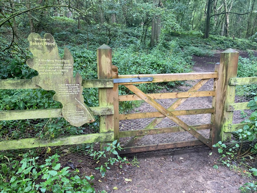
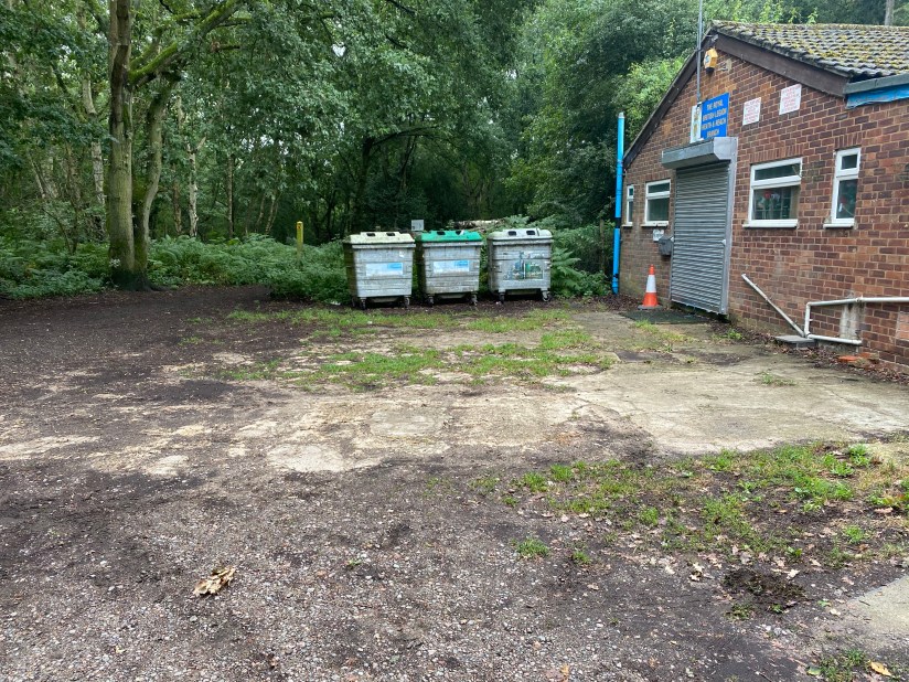
Make your way across the carpark to the path back into the trees. We turned right and then shortly on left into the first turning for Bakers Wood. Continue on this path until you come to a junction with a left / right option and turn right. This is the one part that leads out of Rushmere down to the British Legion building and then back into Rushmere when you go down the footpath next the the bins. I know….such picturesque bins they are!


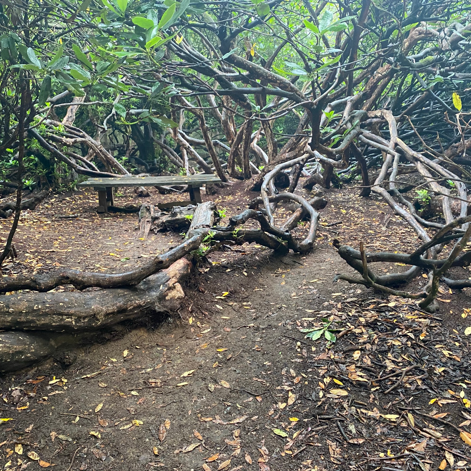
Continue along this path until you come to a four way junction. There should be a cycle route in blue in front of you and a white footpath to the right. Take the footpath marked by a white post. We went up between Shire Oak Heath and Lords Hill. Then down to the left along the left side of Lords Hill next to Heron Valley. Following along the path we saw a curved line of log seats that looked designed for group meetings. We continued along the white marked path down a steep hill that joins back up to the blue cycle path where it curves to the right that takes both the blue and white paths away from the orange bike path and leads on to the entrance road.

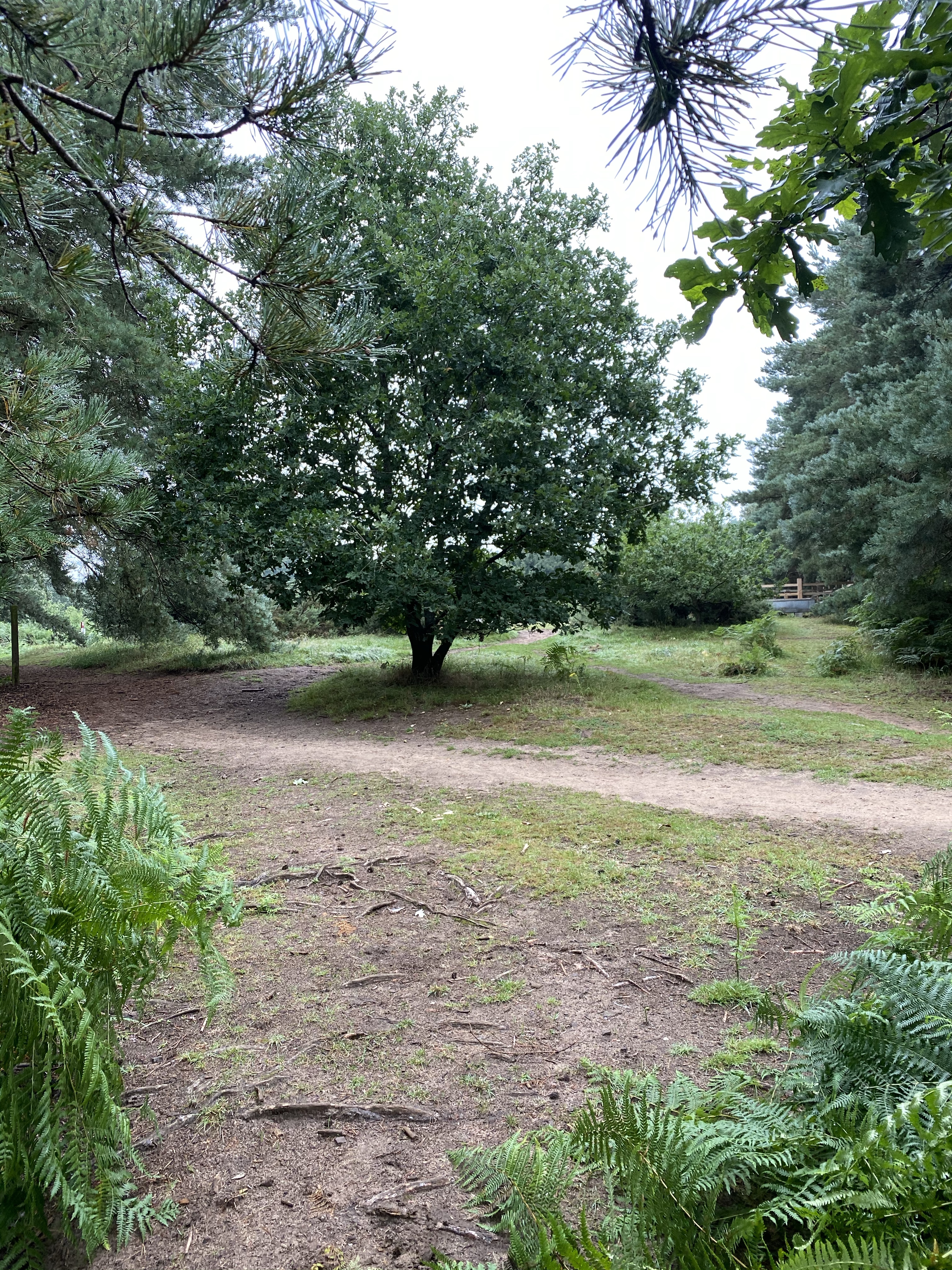
The picture above shows a gate in the Lower meadow. We considered turning here but luckily we did not. The path to the left just goes out of the park. We went straight on and crossed the road baring right on the far side. Now you are on the white path that goes all the way up to the Greensand Ridge Walk.


Turn right onto the Greeensand Ridge Walk and at the next large junction with a four way option you will turn right. Turn right and head for the next large junction. You will recognise this one as the fence and gate where you turned to go to Stockgrove the first time. This time we turn right and head back to the visitor centre.
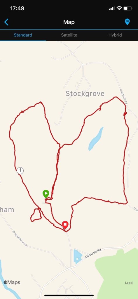
You will notice that there is a small circle near the bottom left. We were a bit naughty and walked on the horse loop. Nothing here said we couldn’t do it at the time but on the big map we now have it says not to walk on the horse paths.
The total walk was around about 4 miles. That at least got us our of our 5k rut we were in. The weather held out right up until we reached the carpark. The fine drizzle turned to a significant sprinkle as we approached out car. We got in and the rain picked up a bit more. By the time we reached the main road out of the park it was a full on downpour. We could not have planned our timing any better.

